3D BAUDOKUMENTATION
& GEBÄUDEINSPEKTION
Digitaler Zwilling im Browser: Modelle, Punktwolken, Fotos und Messungen in einer Organisation.
Sie legen sie selbst an und starten direkt als Editor.
Name, E-Mail, Passwort — ein Schritt, Ihre Organisation.
Professional Grade Tools
Everything you need to manage your digital reality.
Modelle, Punktwolken und Karten
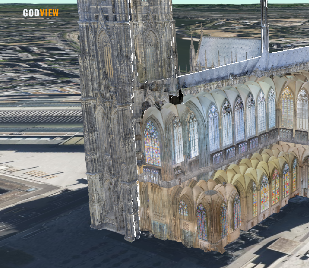
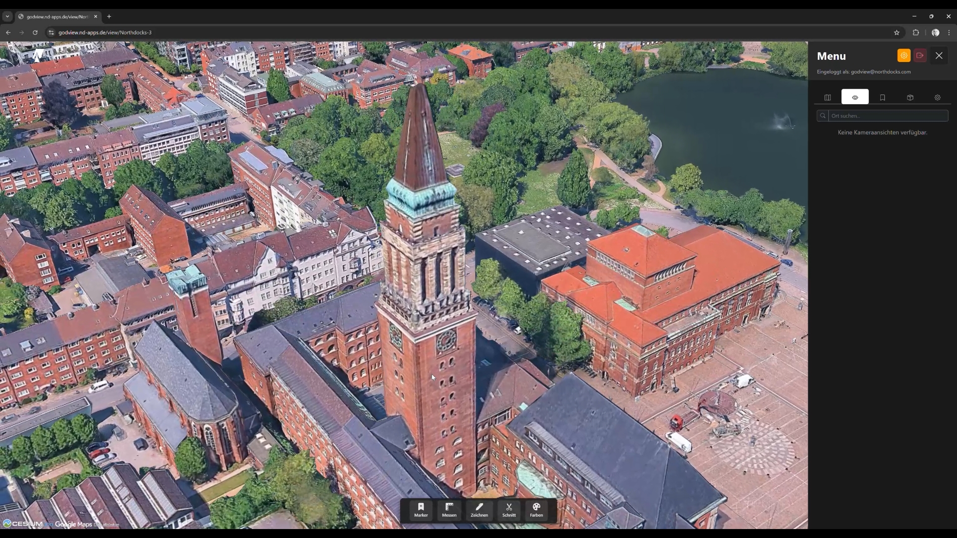
Unter Inhalte laden Sie 3D Tiles, Punktwolken (LAS/LAZ), Gaussian Splats und CAD/BIM (IFC, OBJ, FBX, DXF, STL). Drohnenfotos mit GPS, Orthophotos, KML und Copernicus liegen in derselben Organisation. In der Ansicht schalten Sie Google Earth, OSM-Gebäude und Live-Daten dazu.
- 3D Tiles, Punktwolken und Splats
- CAD/BIM wird auf dem Server konvertiert
- Google Earth, Orthophotos und Live-Geodaten
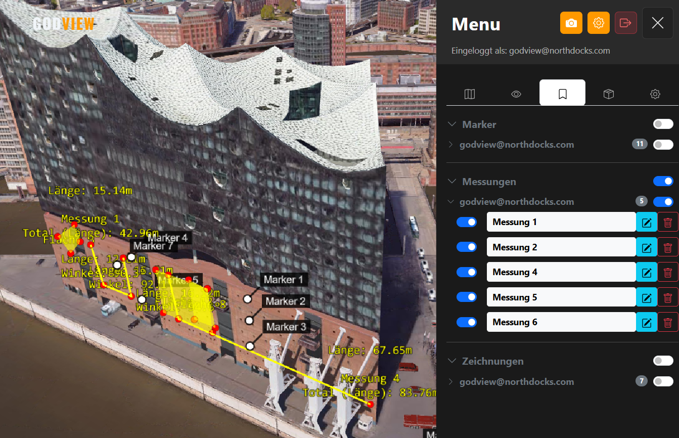
Marker, Messen, Flächen, Zonen, Schnitt
Unten in der 3D-Ansicht liegen die Werkzeuge der App: Marker setzen, Strecken messen, Flächen zeichnen, Radien als Zonen und ein Schnittvolumen durch das Modell. Aus der Orthogonal-Ansicht wird die Fläche zum PDF.
- Messen, Flächen und Zonen
- Schnittvolumen durch Tilesets
- Marker mit Gruppen
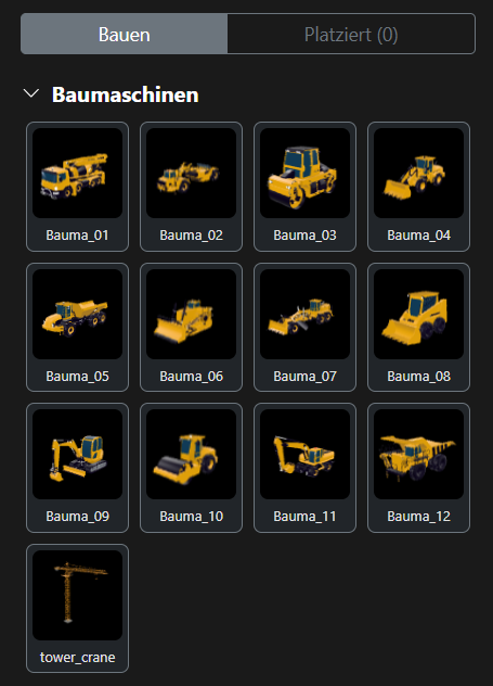
Objekte auf der Baustelle platzieren
Im Seitenmenü unter Bauen ziehen Sie Baumaschinen, Fahrzeuge und eigene GLB-Modelle auf den Globus. Nach dem Ablegen justieren Sie Position und Drehung. Gruppen halten die platzierten Objekte zusammen.
- Ziehen auf den Globus
- Bewegen und Drehen nach dem Ablegen
- Eigene Modelle aus dem Inhalte-Tab
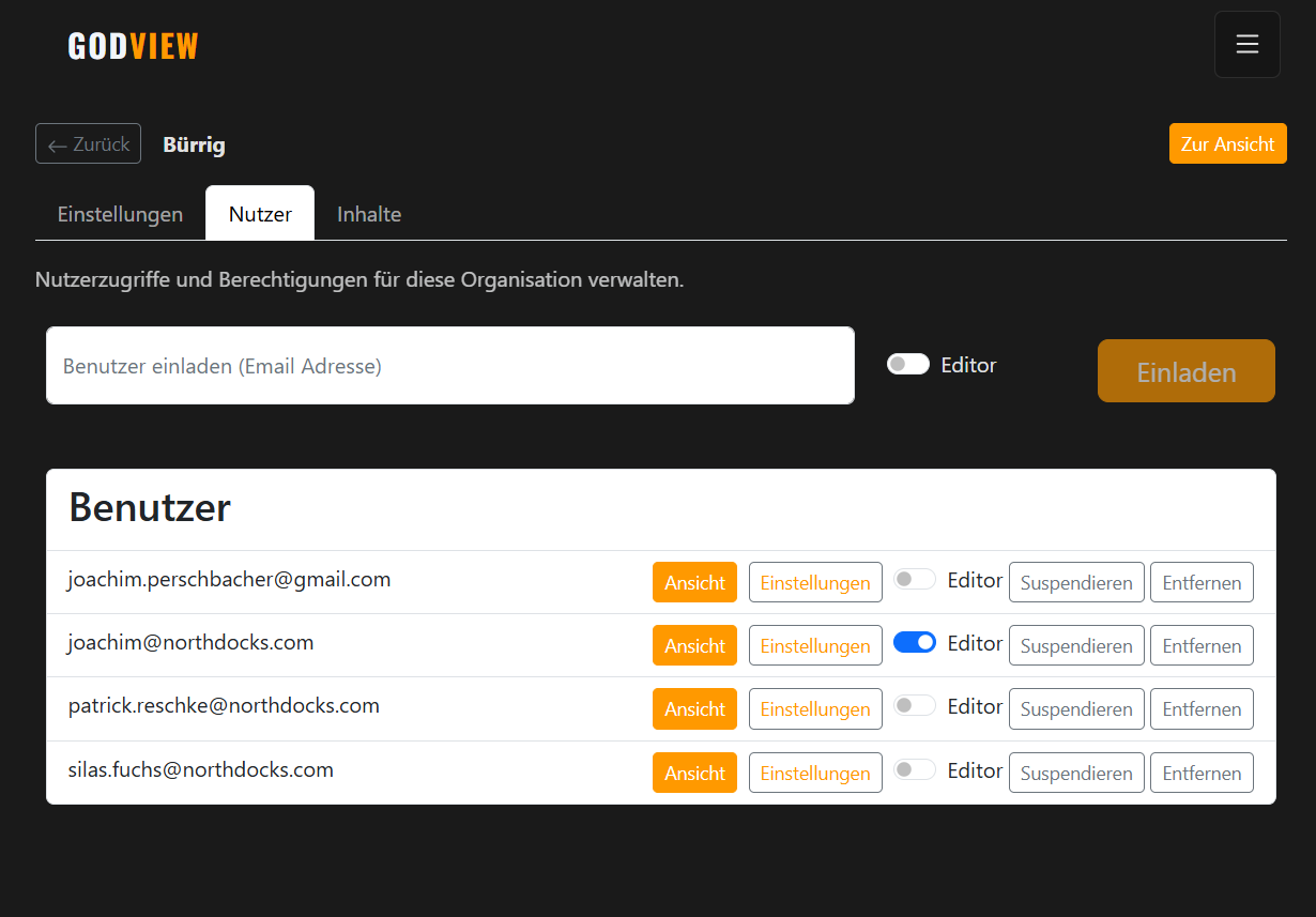
Eine Organisation, klare Rollen
Die Registrierung legt Ihre Organisation an. Sie laden weitere Personen per E-Mail ein: Editoren ändern Inhalte, Betrachter sehen die Ansicht. Stationen speichern Kamera, sichtbare Layer und den aktiven Schnitt — den Link können Sie teilen.
- Eigener Ansichtspfad pro Organisation
- Rollen: Editor und Betrachter
- Einladung per E-Mail, Stationen zum Teilen
Link, PDF und VR-Export
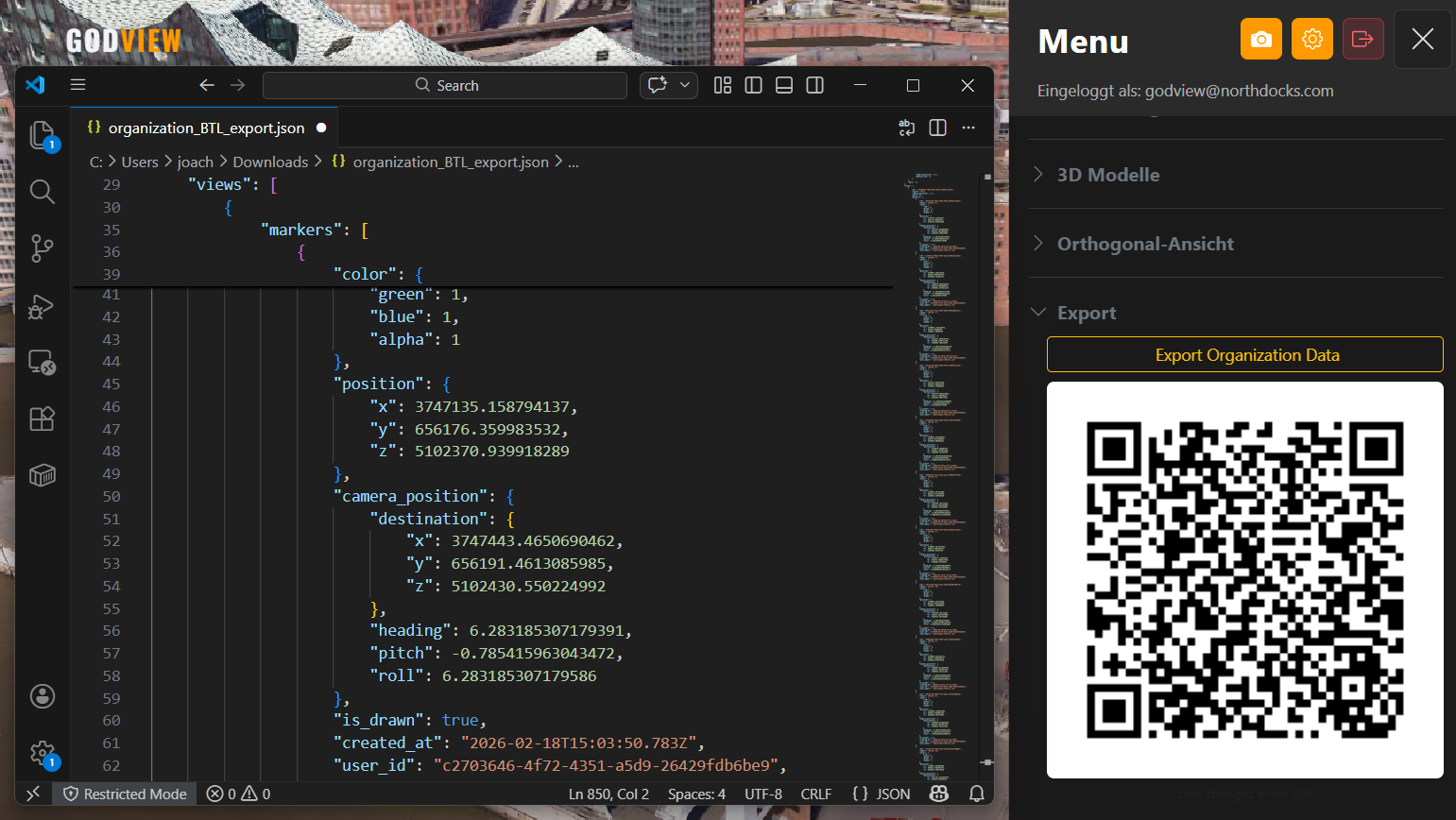
Die Kameraposition steckt in der URL. In der Orthogonal-Ansicht exportieren Sie ein PDF. Editoren erzeugen unter Optionen ein JSON mit QR-Code für die VR-App.
- Link mit Kameraposition
- PDF aus der Draufsicht
- VR-Export mit QR-Code
So arbeitet die Ansicht
Dieselben Reiter wie in der App: Karten, Kamera, Marker, Bauen, Optionen.
Schnitt
Eine 3D-Box schneidet Tilesets auf. Stationen merken sich, welcher Schnitt aktiv ist.
Panorama
Unter Optionen, Navigation: Linksklick fliegt hin, WASD bewegt, Q und E gehen hoch und runter. Für Begehungen auf Augenhöhe.
Farben und Risserkennung
Die Werkzeugleiste Farben regelt Helligkeit, Kontrast und Gamma. Unter Sichtbarkeit hebt die Risserkennung Kanten, Fugen und Materialwechsel direkt in der Ansicht hervor.
Fotos und Inspect
Drohnenfotos mit GPS sitzen im Modell und clustern beim Herauszoomen. Auf dem Smartphone läuft Inspect im Browser und schickt Vor-Ort-Fotos in dieselbe Organisation.
Stationen
Im Tab Kamera speichern Sie Standpunkte mit Layern und Schnitt. Der Präsentationsmodus spielt die Stationen der Reihe nach ab.
Live-Geodaten
Unter Karten, Live: Wetter, Wind, Luftfahrzeuge, Schiffe, Pegel, amtliche Warnungen, Regenradar und weitere öffentliche Lagen auf derselben Ansicht.
Neuigkeiten
Die neuesten Verbesserungen – entwickelt rund um Ihren Arbeitsalltag.
Ihre Baustelle – in Echtzeit begehbar
Navigieren Sie durch Photogrammetrie-Meshes und Punktwolken in voller Auflösung. GodView lädt die Details im Hintergrund nach — Sie bleiben bei der Inspektion.
Jedes Baustellenfoto genau dort, wo es aufgenommen wurde
Laden Sie Drohnenfotos hoch und GodView positioniert sie automatisch anhand der GPS-Daten im 3D-Modell. Zoomen Sie in jeden Bereich – und sehen Sie sofort die passenden Aufnahmen.
Sehen, was das Auge allein übersieht
Schalten Sie den integrierten Kantenfilter ein: Risse, Fugen und Materialwechsel werden sofort auf Ihrem 3D-Modell sichtbar, direkt in der Ansicht. Eine echte Hilfe bei Fassadeninspektionen und Schadensaufnahmen.
Häufige Fragen
Alles Wichtige zu GodView auf einen Blick.
Was ist GodView und für wen ist die Plattform geeignet?
GodView ist die webbasierte 3D-Plattform von Northdocks. Digitaler Zwilling, Fotodokumentation und Zusammenarbeit laufen direkt im Browser. Jede Organisation hat eigene Inhalte, Nutzer und eine Ansicht — für Bauleitung, Inspektion und Vermessung.
Wie integriere ich meine Drohnenaufnahmen in GodView?
Im Tab Inhalte der Organisation laden Sie Drohnenfotos mit EXIF-GPS hoch — sie sitzen automatisch im Modell. Dazu 3D Tiles, Punktwolken, Splats, CAD/BIM, Orthophotos, KML und Copernicus. In der Ansicht liegen Google Earth, OSM-Gebäude und die Live-Geodaten unter Karten.
Ist GodView DSGVO-konform?
Ja. GodView läuft auf Servern in Deutschland. Ihre Daten bleiben in der EU. Die Plattform erfüllt die Anforderungen der DSGVO.
Was kostet GodView?
Die Basisplattform kostet 119€ pro Monat und beinhaltet unbegrenzte Nutzer sowie 100 GB Speicherplatz. Zusätzliche Module (Inspect, Bautagebuch) sind jeweils für +49€/Monat zubuchbar. Individuelle Enterprise-Angebote auf Anfrage.
Kann ich GodView auf dem Smartphone oder Tablet nutzen?
Ja. Sie öffnen GodView im Browser auf Desktop, Tablet und Smartphone. Die Inspect-Seite auf dem Telefon nimmt Fotos mit GPS auf und legt sie in dieselbe Organisation.
Welche 3D-Datenformate unterstützt GodView?
3D Tiles, Punktwolken (LAS/LAZ), Gaussian Splats (PLY), CAD/BIM (IFC, OBJ, FBX, DXF, STL), GLB/GLTF, KML/GeoJSON, Orthophotos, Copernicus EMS und Drohnenfotos mit EXIF-GPS. CAD- und BIM-Dateien werden auf dem Server konvertiert.
Wie lege ich eine GodView-Organisation an?
Über Organisation anlegen geben Sie den Namen, Ihre E-Mail und ein Passwort ein. Danach sind Sie Editor: Sie laden Inhalte hoch und laden Ihr Team ein. Betrachter öffnen die Ansicht.
Simple Pricing
Transparent costs for maximum performance.
Base Platform
Unlimited users and 100GB storage space.
Direkt in der App: Organisationsname, E-Mail, Passwort.
Organisation anlegen
Die Registrierung in der App legt Konto und Organisation in einem Schritt an. Danach sind Sie Editor und öffnen Ihre 3D-Ansicht.
-
1
Organisation
Name Ihrer Firma oder Ihres Projekts -
2
Account
E-Mail und Passwort -
3
Ansicht
Daten hochladen, Team einladen
Schon ein Konto? Anmelden
Individuelle Integration: kontakt@northdocks.com